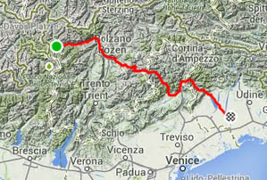
My ride report from the 2014 Transcontinental Race is divided into two parts, with Days 1-7 below and Days 8-14 here. Please visit the Ride Far page dedicated to The Transcontinental Race or the official website if you’re looking for general information about the race instead of a personal race report.
Page Contents:
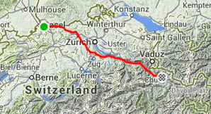
Part 1, Days 1-7
Postscript from 2016: It’s interesting looking back at this report of my rookie edition of the race. I violated several rules of being self-supported in terms of equipment and information, mainly due to not being aware of what the rules/guidelines are. It wasn’t until the 2015 edition of the race that these rules were more clearly stated and emphasized. One of my goals for returning to the race in 2015 and 2016 was therefore to finish the race properly unsupported, which I finally managed to achieve in 2016.
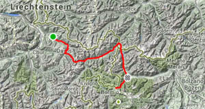
Day 1: London (UK) – Newhaven (UK)
| Distance | 106 km |
| Climbing | 1080 m total (10m / km) |
| Moving speed | 21.5 km/h |
| Ride time | 8 hrs incl. stops, 5 hrs moving |
| View on Strava | |
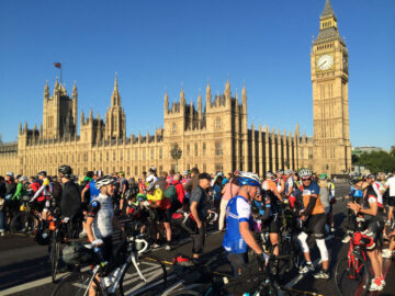
Shortly before 8am, the 87 other starters and myself straddled our bikes on Westminster Bridge, with Big Ben and the Houses of Parliament behind us. The sense of anticipation of what lay ahead was just starting to be realized by everyone. There were well wishes between the riders themselves and from the supporters who had come to see us off. I was suddenly starting to get nervous about what this would entail and what racing across Europe for two weeks with all of these similarly mad people might feel like.
Despite being on the start line for at least 15 minutes, the eighth dong of Big Ben that signaled the departure arrived very quickly and we were all off on this massive adventure very abruptly. Getting caught up and distracted by all of these thoughts, feelings, and emotions meant that I’m not sure that I ever said a proper farewell to my parents and our friends the Warmsleys, who had all come to see me off, but I was very thankful that they were there.
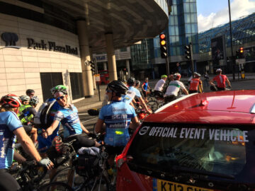
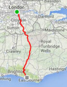
We rode the first km as a group behind the official race vehicle. It felt great to be riding together with so many other like-minded people, but we were soon sent off on our own, mostly lonesome, ways. Most riders were headed for the more convenient Dover-Calais ferry, but I was one of the minority who had opted for the Newhaven-Dieppe ferry, an option that meant riding a significantly shorter distance, but for which the ferry timing was far from ideal because the ferry didn’t leave until 10:30pm that evening, whereas the people heading to Dover would be getting onto French soil more than 12 hours earlier than us.
I saw a few other people ahead who also took the road to the south coast instead of Dover, but after a few hundred metres they continued straight, whereas I needed to turn left to follow the route that I had plotted. There are many ways to get through London, and maybe they knew something that I didn’t, so I considered following them, but I decided to stick to my original plan and was then all alone. Shivers of anticipation again went down my spine as I was now truly embarking on this solo voyage.
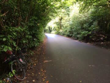
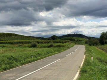
I knew most of the route from London, through Paris, across Switzerland, and into the Italian Alps quite well because I’d ridden some sections earlier in the year specifically as preparation for this race and I’d done other sections as parts of other rides in previous years. However, I hadn’t ridden the first 20 km that took me from central London to the M25 ring-road that encircles the city. I had chosen what looked to be quieter roads that avoid the main population centers, but I had not expected my route to be as quiet or as scenic as I now found it – I passed many parks and woods while slowly leaving the metropolis behind.
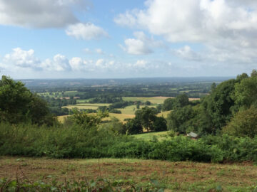
I took the riding extremely easily because I had all day to do the 100 km (60 miles) down to Newhaven, and so I made several stops once I was free of the city. The first was at a small café, where I refueled and made my first in-race Facebook post. There were several good climbs to do as I went up and down the ridges of the North and South Downs. At the highest point of the day, amid a protected wilderness area, I found an ice-cream van in a parking lot that is a popular starting point for hikers, so I took advantage of that to take another break and have my first of what would be many ice creams during the race.
Despite taking it easy, I kept feeling little twinges of discomfort from different parts of my body – thigh, hip, knee, neck, etc. I was pretty sure that this was just me being over-sensitive and worrying about whether my body was ready for this greatest test that I’d ever given it, but the sensations certainly gave me something to think about.
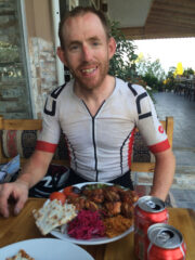
When I arrived in Lewes, the main town that is just before the port of Newhaven, it was still early afternoon. I found the supermarket and bought enough supplies to keep me going for the next couple of days because I didn’t want to search around for food when riding through France when I could be pedalling. I also took a short look around the pedestrianized part of Lewes, and while doing so, I was stopped by a guy who asked whether I was part of the TransContinental Race. I was surprised to find someone who knew about it, but it turns out that he worked for Pivot Cycles, who the race organizer, Mike Hall, knew well because he used their bikes on several of his wins of similar events around the world; the guy I’d met had built the wheels that Mike used to set the record for riding around the world. It was nice to feel a bit like a sports star, although I had to explain to him how the race hadn’t really started for me yet.

After delaying for as long as I could, I headed down to Newhaven and found a quiet place to lay down for an hour or so and got a bit of sleep. With my late-afternoon siesta done, I went down to the port, where I found more than a dozen other TCR riders waiting for the evening ferry. I had dinner with Pippa, from Edinburgh, and Chris, a Canadian living in the South Island, New Zealand. They were both great to chat to and I hoped that I would see more of them during the coming weeks.
After being in the waiting room for far too long, we were happy to be given the chance to finally head out onto the parking lot where we could wait to board the ferry. We were still a long way from boarding time, and as we looked at the tracker and saw people who had taken the Calais ferry riding south through France at a decent speed, some of us were strongly questioning whether we had made the right decision.
While waiting there, I met a few other interesting people including Ellie and Dave. They were both hoping to make the finisher’s party in Istanbul on the 15th day, but had underestimated how tough this would be. They would end up being some of the last people on the road, arriving a few days after the party, but their strength and determination is still very admirable, each overcoming many obstacles along the way.
When we finally boarded the ferry, I headed straight for the comfortable chairs in which I’d been able to get 2 or 3 hours sleep during the 3.5 hour crossing when I had done it in February. However, the situation was now very different, and I had a hard time sleeping due to my brain thinking about the race, all of the fantastic people that I had just met, and everything else that was about to come.
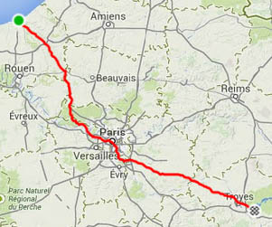
Day 2: Dieppe (France) – Paris (France) – Troyes (France)
| Distance | 360 km |
| Climbing | 1850 m total (5m / km) |
| Moving speed | 24.1 km/h |
| Ride time | 18 hrs incl. stops, 15 hrs moving |
| Previous night | 11 hrs stopped, 3 hrs asleep |
| View on Strava | |
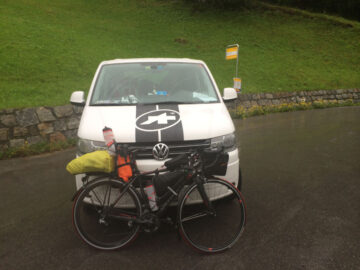
With the ferry due to dock at 3:30am, it would be my earliest start time of the whole race, plus my legs were full of energy, so I had made an ambitious plan and booked a hotel 360 km away from the port. That would also be the ideal location to make it possible to reach Basel, Switzerland by the end of Day 3, where I’d booked a hotel for my wife Heather to take the train from where we live in south-western Switzerland and meet me. I impatiently waited for the ferry to dock because I was full of energy and wanted to start moving NOW.
Also waiting for the ferry to dock was a group of young British guys who were doing a more traditional bike tour. They were discussing the “super-long” ride they had ahead of them that day – 160 km! This was less than half what most of the TCR guys were planning to do and showed me that our ride could no longer be thought of in the same category as regular bike touring.
The cyclists were first off the ferry, and I was the first through customs and on the road – the race had finally started for real. Many people had just assumed that the main road out of Dieppe would be the fastest way, but hadn’t done the research that I had and so didn’t know that this meant doing a decent climb straight away, whereas the back road following the river valley was totally flat and very direct, so that’s what I took.
After a while, the bike route along the old train line started. I decided to stick to the road, which tends to be better lit and more interesting to ride on at night. However, when the road was about to become a bit hillier, I hit the bike path and was pleased to find a great surface and easy riding. I did encounter a few unusual dangers on the bike path: the first was a sleeping cat, who I tried to give a wide berth to when passing, but it got startled, jumped up, and ran straight into my front wheel as I passed at speed. Fortunately, it bounced off my tire and rim, didn’t knock me off line and didn’t seem too affected itself so I kept going, but it was a bit of a scare for me and it. A few kms later, I was weaving through a set of gates that stopped cars getting onto the path and I just about realized in time that there were two guys sleeping on the path. It seemed that they’d had a few too many drinks the previous night and hadn’t quite made it home by the time I came by at 6am Sunday morning. Fortunately, that marked the end of the night-time bike path riding, and I was on roads from then on, which had far fewer surprise hazards.
Shortly after sunrise, the first other rider came past me with a pleasant “Good Morning.” It was Pippa, who I’d eaten dinner with the evening before in the café at the port. She was riding very strong, and I kept her in my sights for several kms – she would gain a bit on the flat, and I’d gain it back on the uphills. I had no plan to really race, so I eventually let her slowly disappear into the distance. I didn’t see any other riders until getting to the first checkpoint in Paris, mainly because most of the other people who had taken my ferry were the ones who were not trying to go fast and had chosen the less convenient ferry ride merely to keep the distance down.
The night ride had been pretty much flat, but in the morning there were a few climbs to do to get into the Seine valley, but I was able to achieve my goal of getting there by 10am, which meant that most of the southerly riding for the day was done before the wind had a chance to pick up. The guys who had taken the Dover-Calais ferry and who hadn’t ridden through the night were now being faced with a strong headwind all the way into Paris, which I had pretty much avoided entirely, so I was starting to feel better about my route choice as I started to make up ground.
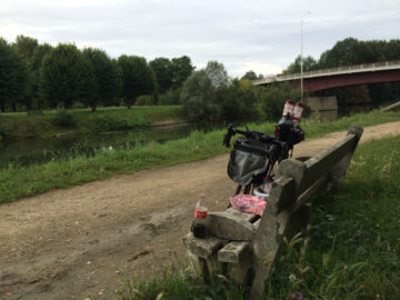
I still had a couple of hours riding to do along the Seine river and over a couple of bumps to get into Paris, so before that I had second breakfast on a bench by the Seine. It was then a lot of suburban riding but because of the recon’ that I had done of the route back in February, I knew that the traffic wouldn’t be a big problem, especially not on Sunday morning. I also knew that when going through the center of Paris on the one-way streets, the lights are well-timed so that you can make it through with only a few stops. Other people tried to swing far south to avoid the city, but that was certainly the slower option at that time of the week.
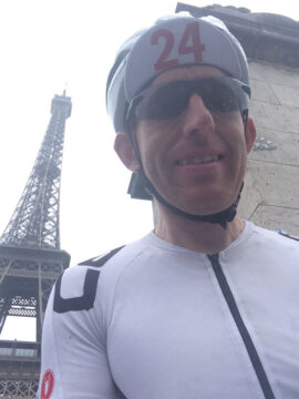
My route took me right past the Eiffel tower, so I stopped for a quick selfie to post online. Heading out of the other side of Paris, I was on a mix of riverside bike paths and half-empty roads until I got to the first checkpoint in the suburb of Montgeron – the Café Réveil Matin, where the first Tour de France started back in 1903. Unfortunately, the café was closed for their summer break, but I had sandwiches and other snacks in my bags that I ate while chatting with the race organizers. Of the 88 starters, I was the 30th to reach the control point, so my ferry choice obviously wasn’t so bad afterall. Even so, I had only done half of the day’s riding and I was eager to see how my body would feel for the second half.
From Montgeron, almost all racers were heading in a very similar direction to get to the Swiss city of Basel because we were all trying to avoid the Jura mountains further south and the Vosges mountains further north. There was one obvious road heading that way, but how to get onto it from Montgeron was not so obvious. I used what I’d learned from my recon’ ride to take a route that involved a lot of turns, but not much distance. I hadn’t been too sure about the very last section of this that I hadn’t done in my previous ride, and it turned out that I did have to ride around a barrier and do a couple kms along a dirt road, but I then joined up with the prime-choice road having done far fewer kms than anyone else, so I felt pretty proud of myself.
By mid-afternoon, the wind had really picked up, but was mostly a crosswind for those of us who were clear of Paris. It was strong and blustery, so it took a lot of concentration to keep the bike going straight, and there was the extra hazard of dodging some fair-sized branches that had been blown down onto the road. I could see dark rain clouds forming all around, I was lucky enough to miss them for a while but eventually one caught me and I got soaked, but I had good rain gear, it wasn’t cold, and I knew it wouldn’t last long, so I kept riding. It dried up for a while, but just after I stopped at a bakery in a small town, it started again and so this time I took shelter until it had mostly passed.
The evening ride was dry with a slight tailwind and I made it to the hotel before 10pm, after stopping at McDonalds to get some fast, hot calories.
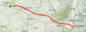
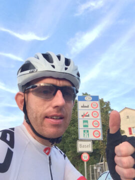
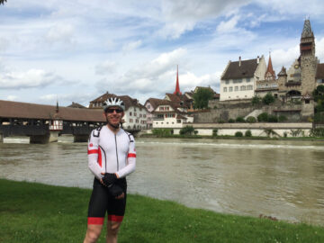
Day 3: Troyes (France) – Basel (Switzerland) – Germany
| Distance | 306 km |
| Climbing | 2380 m total (8m / km) |
| Moving speed | 25.8 km/h |
| Ride time | 13.5 hrs incl. stops, 12 hrs moving |
| Previous night | 9.5 hrs stopped, 7 hrs asleep |
| View on Strava | |
I had checked the tracker website a few times the previous afternoon to see where I was in relation to the other riders, and had noticed that by the end of the day, many had stopped in Troyes, whereas I had pushed 20 km further on to the hotel that I found on a quite empty stretch of the road during my previous riding of the route. I was up reasonably early and on the road by 7:30am, but soon learned that this was late compared to most other TCR riders, most of whom had got a head start on me.
The vast majority of riders were using the same road for the next 200 kms and because it was so early in the race, we were all relatively close together. In every village that I went through, there was often one or two rider’s bikes parked outside the bakeries and petrol stations, so I knew that I was passing people but it also meant that there was great pressure not to stop too often myself, which I was able to do due to filling up with supplies at the English grocery store two days earlier. I had never planned to race this event, but by now I was inside the top 20 and the temptation to maintain my place was very strong.
To get to Basel in time for dinner with my wife Heather, I had to keep up a good speed, and with the slight tailwind was able to achieve my best daily average of the whole race – almost 26 km/h for the 306 km route. The final 100 km was another section where the ideal route was not obvious, and I was happy to have scoped out some options beforehand, which allowed me to reject some slow backroads before Belfort and to find another after Belfort that saved doing a steep climb on the main road. My route turned out really well and when I checked the tracker website when entering Basel, I was excited to see that there were only about 15 people ahead of me!
Despite my surprisingly good placing, I had decided to get out of “race” mode once reaching Basel. Heather and I had a nice pizza across the street from the hotel, and I got an early night to catch up on the sleep that I’d missed the previous two nights.
Day 4: Germany – Lake Zurich (Switzerland) – Landquart (Switzerland)
| Distance | 205 km |
| Climbing | 1630 m total (8m / km) |
| Moving speed | 23.4 km/h |
| Ride time | 12 hrs incl. stops, 9 hrs moving |
| Previous night | 12.5 hrs stopped, 8.5 hrs asleep |
| View on Strava | |
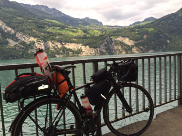
Heather and I had a relaxed breakfast at the hotel and didn’t get going until around 9am – race mode had really been forgotten about. Heather rode with me for the first 120 km, which made the ride through the Swiss valleys and over bridges across several major rivers really nice (crossing the Rhine, Aare, Reuse, Sihl, and finishing on the shore of Lake Zurich). We also went over my first official mountain pass of the trip – the Bözberg, although that is only a small one, topping out at 569 metres altitude. On the far side of the pass, I was very glad to be able to re-stock with food supplies at a Swiss grocery store – life is so much easier when all of the options are familiar and I can get just what I normally eat, including my favorite chocolate muesli.
Heather was careful not to give me any “support”, because that would be against race rules, but thankfully she resisted the urge to make up for her camaraderie by yelling insults at me. After she left, I headed for the bike path along Lake Walen that few other racers knew about – most of them stuck to the road that required them to do an extra 300-metres of climbing. Lake Walen is one of my favorite Alpine lakes, and the bike path which passes through some old rail tunnels is truly fantastic, so I was still taking it easy and just enjoying myself.
Shortly after the town of Sargans, where I rejoined the Rhine valley, I checked on the upcoming weather. It was forecast to start raining that night and continue throughout the next day. This wasn’t good news because I was about to head into the Alps and up to the highest roads of the whole race. I decided to do as much as possible in the dry by continuing to ride that evening until the rain started. Unfortunately, the rain already started around 9pm and by then it was also getting dark, so I decided to pitch the tent on a forest track just off the main road and stay dry until the morning. At the time, I had no idea how epic the next day’s ride would be.
Day 5: Landquart (Switzerland) – Austria – Prato (Italy)
| Distance | 187 km |
| Climbing | 4340 m total (23m / km) |
| Moving speed | 18.2 km/h |
| Ride time | 14.5 hrs incl. stops, 10 hrs moving |
| Previous night | 8 hrs stopped, 6 hrs asleep |
| View on Strava | |
When it started to rain the previous evening, I had pitched my tent up a forest track a short way off of the road. I had set my alarm to wake me at 4am to have breakfast, pack up, and get on the road by 5am, so that I would have at least a couple hours of riding in the dry before the rain was forecast to start again. Unfortunately, the plan wasn’t all that successful as the rain started less than an hour after I got on the road. In Klosters, I tried to wait out the rain in a bus shelter while having a second breakfast, but after 20 minutes it hadn’t let up and so I continued the climb in the wet. I was worried what the temperature would be at the top of the Fluela pass, which is 1200 metres higher than where I currently was, because I was already only just warm enough.
The motivation to stay warm helped me to keep a good pace on the wet climb. A few kms past the town of Davos, which is about halfway up, I spotted a familiar sight – a white van with Assos logos; this belongs to Jean-Michel who is our local representative for the Swiss bike clothing brand. He lives near Lausanne and is a good friend because he often visits the bike shop where I work to have a chat (and occasionally to do some work). He said a few weeks earlier that he could come to see me on the Stelvio Pass. The Stelvio Pass is the most famous climb in Italy, and one of the highest in the Alps. The second race control point was at the top, so I hoped to reach there that afternoon. However, I hadn’t really believed that Jean-Michel was serious about coming. Fortunately, he had a meeting on that side of the country the previous day, so had contacted me via Facebook to let me know that he was there and that he was watching my tracker position.
Jean-Michel had found a cheap hotel on the Fluela Pass the previous evening, and luckily I spotted his van as I rode past. I decided that since it wasn’t even 7:30am yet, I’d let him sleep and instead looked forward to him finding me later in the day. Despite not seeing him, the boost of encouragement that I got just from seeing his van was great.
I found one other racer on the climb, who had not slept very well in a bus shelter on the edge of Davos the previous night. We chatted for a while to take our minds off of the miserable weather – about 5 degrees C and steady rain on top of the 2300+ metre-high pass. I explained to him that after the descent, we would get two options: we could turn right and take the shorter way to the Italian town of Prato, where the big climb up the Stelvio had to be started from, but that this route involved two long climbs and going above 2000 metres altitude for a second time, where it would again be bitterly cold. My plan was to take the other option, to turn left, do quite a bit more distance, but at a much lower altitude and only have one climb that was much lower; the descent from which was far more straightforward and so safer in the rain.
I had got ahead of the other guy by the top and decided not to wait for him so that I would spend less time in the cold and could descend at my own pace, taking every corner cautiously, but not wasting any time in getting down to lower, warmer altitudes. The descent went OK, and I passed two more riders who were taking it even more cautiously than I and who appeared to be shivering much more – so I took heart in the fact that it could be worse and that I had done many descents in similar conditions before, whereas most other people in the race had no such experiences to draw upon. I also had full fenders (mudguards) and reasonably good rain clothing, which not many others did, so I knew that I could keep riding in this weather whereas most of the others would need to stop somewhere warm for a while to recover.
I finally got down to the valley of the Engadine (or Inn) river, and onto the flatter road. It still wasn’t as warm as I’d hoped, so I had to take advantage of every little rise in the road to do a short sprint to keep the body temperature at a sustainable level. Unfortunately, my energy level was now starting to wane and I needed to eat more, but since I didn’t want to stop (I knew that I’d cool down too quickly if I did), I tried to survive on some energy bars and gels that I had in my easy-access top-tube bag. It took a lot longer than I was expecting to get to the second climb of the day, the Reschen Pass, which was almost 40km from the end of the previous descent.
The Reschen Pass took me from Switzerland, across the corner of Austria, and then down into Italy. My lack of food intake caught up with me on the climb and I struggled to keep a reasonable pace, but I thought that it wouldn’t be far from the top (which is at 1500 metres altitude) to Prato, the town at the base of the Stelvio Pass. By this time, I had already formed my plan to check into a hotel in Prato, to eat and warm up, and then decide whether to climb the Stelvio that afternoon, the next morning, or maybe skip it altogether since the forecast was calling for constant rain for at least the next 24 hours.
Unfortunately, the top of the Reschen Pass was far flatter than I had remembered, with about 20km to ride on the high plateau and around two lakes before doing the descent. The wind and rain were a bit wild on the descent, and I was starting to shiver, but since it wasn’t as bad as when I’d done half of the AlpenBrevet cyclosportif event in the rain over many Swiss Alpine passes, I knew that I would be OK. Afterall, this time the shivers weren’t making my bike feel like it was about to fall apart as they had done then!
Even after the descent, I still had another 8 km on the flat before reaching Prato, and the wind and rain was getting worse – I just wanted to be there and get out of the wretched weather. It was then that I saw Jean-Michel’s Assos van heading the other way with his arm waving out of the window. When I pulled over to talk to him, he saw the condition that I was in and agreed that checking into the first hotel in Prato was the only sensible solution, so he went on and waited for me at the edge of town.
I’m still not sure whether it was the right decision in terms of time, energy, and conservation of body heat to take the longer, flatter route to Prato instead of the shorter, more mountainous route, but there was one thing that I did achieve with my choice. When the control points for the race were first announced last autumn, I had thought about making my route interesting by trying to ride through as many countries as possible along the way, which could have been up to 19. When planning the route in more detail, I had realized how much of a challenge just doing a basic version of the route was going to be, so had mostly abandoned this idea. However, partly as remnants of this original plan, I had passed through a small part of Germany near Basel, and with this long detour through Austria to avoid some higher mountains, I had made it possible to complete a more reasonable goal of riding in 14 countries in 14 days by the time I got to Istanbul.
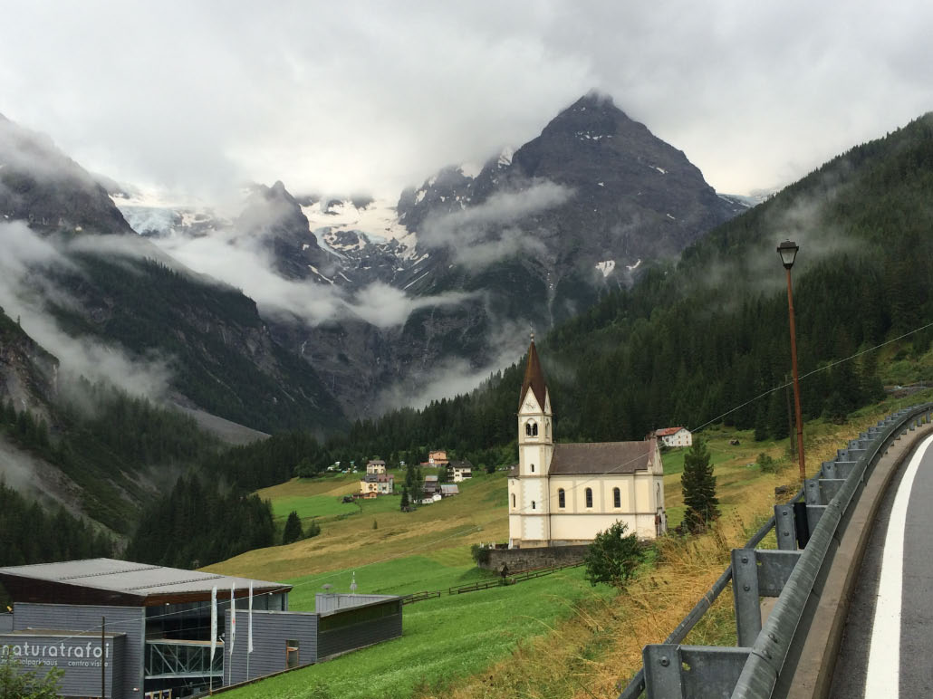
I quickly found a hotel in Prato, and didn’t care about the rather high cost. When I got into the privacy of my room, I literally roared with relief that I had managed to ride through 7 hours of rain in the mountains and got here safely. It was about half an hour before I was showered, warmed up, and came down to find Jean-Michel in the hotel’s café. Jean-Michel had brought his bike with him because he’d hoped to climb the legendary Stelvio Pass, something that he’d never done before, but had now resigned himself to having to drive back to Lausanne without doing it. He had already driven up the climb and cheered on some of the other racers in the rain that morning, so understood my decision not to head up to high altitude (2,800 metres) in the current conditions. We had something to eat and drink together, and I thanked him for the visit, which had certainly lifted my mood at a time when it was most needed.
I went back to my room, laid my tent out on the balcony to dry off and washed my clothes. When I laid down for a rest, suddenly the sun started peeking through a gap in the clouds. A few minutes later, the gap in the clouds had become bigger, and the forecast said that there wouldn’t be a better time to climb the Stelvio in the next 24 hours, so even though I really wanted to rest, I knew that if I wanted to make this climb, it would need to be at that moment, so I put the newly-washed, partly damp clothes back on and headed out.
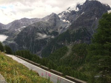
The first half of the climb is not too steep, and starts at a reasonably low altitude (900m), so I was plenty warm enough. The rain kept threatening to start again, but there were also periods of sunshine. The amount of water, loaded with dark sediment that was crashing down the river was seriously impressive – it seemed that half of the mountain was being washed down to the valley below by the constant rain. There were many firemen looking into the river, and they had completely closed a side road – it appeared that they were looking for someone who had fallen in or who had had an accident while kayaking down the raging river.
The second half of the 25 km (16 mile) climb is the steep part, rarely dropping below a gradient of 8%, and this is where the switchbacks are tightly packed together, with 46 of the famous 48 switchbacks coming within the last 14 km. I went up steadily, gauging my effort because I knew from the previous two times that I’d climbed this monster just how much energy I would need to get to the top.
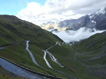
The upper section of the climb starts at 2200 metres altitude, and by then it was still mostly dry and I was feeling OK, so I knew that I’d be able to make it to the top no matter what happened with the weather, which was a big relief. That didn’t make it any easier though, and by the final kilometre, the last few grueling switchbacks, I had almost no energy left, and it was starting to rain again, but I could feel the top.
The race organizers were in the restaurant just on the other side of the pass, so I dashed in quickly to get my brevet card stamped and planned to rush out again just as quickly to get back down the mountain before it started to rain too much more and before I had a chance to get cold because it was just a couple of degrees above zero up there. Sam, one of the organizers, delayed me for a couple of minutes to ask some questions and film me saying where I had slept last night – they later included my response at the start of one of the official race videos.
Brevet card stamped and filming done, I headed back down the mountain, ruing every one of the 48 switchbacks, which are absolutely no fun in the rain and just caused it to take longer to get back to the warmer altitudes and the warm hotel room. Once safely down, it was so nice to pull straight into the bike garage, go straight up to the second warm shower of the day, and straight down to the restaurant for my sumptuous 5-course meal.
I was the 26th rider at the top of the Stelvio pass, so I was pleased that my far more relaxed pace since Basel hadn’t caused me to lose too many places.
Day 6: Prato (Italy) – Bolzano (Italy) – Belluno (Italy) – Codroipo (Italy)
| Distance | 301 km |
| Climbing | 3070 m total (10m / km) |
| Moving speed | 22.2 km/h |
| Ride time | 17 hrs incl. stops, 13.5 hrs moving |
| Previous night | 12.5 hrs stopped, 8.5 hrs asleep |
| View on Strava | |
The breakfast buffet at the hotel was one of the best I’ve ever had and I took full advantage of it. Checking the tracker, I saw that many people had already started out that morning, or had ridden more the previous evening after going up the Stelvio. I could have also continued riding down the valley for a while the previous evening because it was mostly dry then, but I was happy with my decision to get refueled and well rested in the hotel, because now I was ready to have a big day on the bike, especially since the weather was looking like it should stay mostly dry in the direction that I was headed.
It was downhill or flat for the first 80km into the city of Bolzano. I knew there was a separated bike trail all of the way, but I also knew from having ridden most of it when going up the valley once before that it was a bit convoluted, with many tight turns in sections, and that the road might be faster. I had therefore planned my route to use the road for the fast downhill sections and take the bike trail for the flatter sections. My plan worked to perfection, and I avoided all of the inconvenient sections of the trail, but also avoided the busy road for the most part.
In Bolzano, I had to ride across the center of the city to get to the other mountain valley that I wanted to head up on the other side. I had felt a bit of mild pain just below my knee cap on and off during the morning, but had ignored it because it often happens when I ride a lot for several days in a row, so I took it as just a message to say that the previous day in the mountains had taken its toll on my body. However, in Bolzano it suddenly became an intense, searing pain as I pulled away from a traffic light. The pain soon died down, but then another blast of searing pain came. This wasn’t something that I’d ever felt before, and I wanted to do something about it. I decided to blame it on raising my saddle about 6 weeks earlier.
Fred, the owner of the bike shop where I work, does a lot of bike fittings and had measured my position on the bike and said that I was way lower than his method (the BG Fit method by Specialized) recommends. He wanted to put the saddle up by around 2 cm, but anything more than 1 cm made my hips rock all over the place, so that wasn’t possible. I went with just 5 mm higher, which had felt OK for the 2000 km riding that I’d done with the new height before the race, but now it really felt that my knee didn’t want to stretch down so far. I therefore stopped to put my saddle back to its original height and hoped that it would fix the problem. Thankfully, I didn’t have any more episodes of searing pain, although the mild pain that I’d experienced often before was with me for most of the rest of the race, being particularly noticeable in the mornings, but almost disappearing once I was well warmed up in the afternoons and evenings.
Fortunately, I only descended a few hundred metres between the two, so the second one wasn’t that long. This was the most direct route from the Stelvio Pass to Slovenia and the Balkan States, but only one other racer chose to do it, the rest choosing a far flatter but longer option further south.
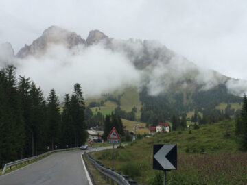
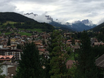
I’d looked at the elevation charts and distances when choosing this route, but hadn’t spent much time thinking about this section. I was therefore slightly surprised to realize that I was pretty much in the heart of the Dolomites region of the Alps, with their iconic jagged, rocky peaks.
I had two big passes to do that afternoon, topping out at 1700 metres and then 1900 metres, but Bolzano is only about 200 metres altitude, so it was a long time before I reached the top of the first one.
During the afternoon, the clouds had come in, and although it was mostly dry, the rain was always threatening and pushing me to keep going to get over the climbs before the weather got worse. Fortunately, the famous Dolomitic rock formations were occasionally peeking out between the clouds, and I treasured every glimpse that I got of them.
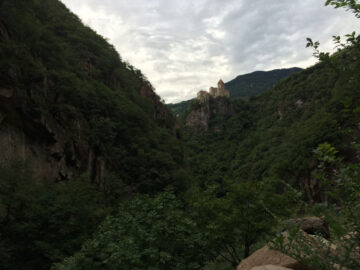
It was a long way down from the final big summit to the next major town of Belluno. For the first time, I was in a region that I had never visited before and I was having a hard time getting my bearings as to where each valley was headed. After the town of Agordo, I entered a fantastic gorge that I certainly hadn’t been expecting.
Earlier in the day, I’d received a text message from Kathy, an Australian friend from Lausanne. She was in Venice with her mother and would be heading up to the Dolomites during the day, and wondered whether we could meet up somewhere. I gave her my rough plan for the day, and fortunately she found me riding down this great gorge on the way to Belluno. We decided to meet up in the town for a pizza.
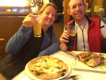
I got lucky when asking at a local bar about the best pizzeria around, and was directed to a wonderful place where Kathy and her Mum found me to enjoy a great meal together. It was nice to see more friendly faces from back home, and to hear how Kathy’s partner Carsten, along with many others, was really enjoying following my progress online.
After dinner, I planned to take advantage of a dry forecast to do a bit more riding, and make it all the way out of the Alps before the end of the day. I always struggle to find good places to buy food in Italy, rarely finding small grocery stores, the petrol stations often selling nothing but petrol, and when I do find a store it is often closed because of their bizarre hours. Fortunately, when leaving Belluno at 9:15pm I found a large grocery store that was still open! I took advantage of it to refill my bags with snacks and drinks.
I headed for my final Alpine pass in the dark – a shortish climb going up from 200 metres to 800 metres altitude. The climb was fantastic, on a small road that overlooked the valley from a cliff; I could see the lights of the town below and the peaks on the other side of the valley being lit up by the ambient light. I then went through a series of short, rocky tunnels into the valley behind, where the road rolled along for several kms before reaching the real summit. While in the valley, the moon rose through a gap in the mountains ahead and I was absolutely loving the night riding. There was a simpler, flatter route that I could have taken from Belluno, but it was a bit longer, and I was pleased to have chosen to do this one last climb because it was an awesome experience.
The descent posed no problems in the dark, and I then followed a riverbank for many kms, around a lake, and was enjoying all of this in the moonlight and the illumination of my dynamo-driven headlight. I eventually reached the section that was one of the main reasons why I had decided to ride this section at night – a 4 km long tunnel. From the maps that I’d looked at there did appear to be an old road out of the valley that should still be open, but the new tunnel was by far the most direct and straightforward way. Like all cyclists, I’m not a big fan of long tunnels, and this would be the longest that I’d ever done. But at night-time, the tunnels are actually better lit than the normal roads, so it’s not really a concern. Plus, when it’s 1am in the morning, there are almost no cars on the road, and being slightly downhill, I was able to ride at about 45 km/h through the tunnel so it only took about 6 minutes and I only saw one car in that whole time.
After leaving the Alps, I was on the flat Italian plains. I knew that I had to use a couple of long bridges to get over some major rivers in the next 40 km, and that the traffic would all get bottlenecked towards the same bridges, so it would be busy during the daytime. So after a brief stop to eat something, I decided to get this section done in the middle of the night to avoid all of the traffic.
One bridge that I had chosen was on a very minor backroad. On the way there, I saw signs about the road being closed, but I decided to persevere and see what happened before turning around. When I reached the river, I found that there was no bridge, and there never had been! Instead, across the 1km wide, gravelly river bed, they had simply made a raised section of gravel that the road goes across. The river bed looked virtually dry despite all of the rain, and the wheel tracks coming off of the gravel showed that several cars had gone through recently, so I hoped that it would be OK. On the raised strip of gravel, there were some large puddles and divots that I had to avoid, but other than that it was easy to ride over, and it was a very surreal experience at 2am in the morning.
With all of the major river crossings done, I decided at 3am that it was finally time to stop and get some sleep, so I camped down a side-road on the edge of a fruit orchard. I set the alarm to get up early so that I could continue to take advantage of the dry weather, because later in the next day there was more rain forecast.
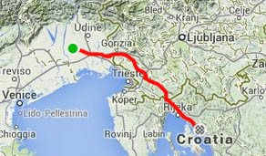
Day 7: Codroipo (Italy) – Slovenia – near Rijeka (Croatia)
| Distance | 205 km |
| Climbing | 1490 m total (7m / km) |
| Moving speed | 22.0 km/h |
| Ride time | 15 hrs incl. stops, 9 hrs moving |
| Previous night | 3.5 hrs stopped, 2.5 hrs asleep |
| View on Strava | |
I was back on the road early, before 7am, having only allowed myself a few hours of sleep. There was not much traffic so I stayed on the easier, main road rather than taking the backroad that I’d planned. It was Friday morning, and I couldn’t understand why the amount of traffic wasn’t increasing, but I eventually learned that it was a partial holiday in the region due to some religious date. Unfortunately, this made finding a place to buy food even harder. My energy levels were the lowest that they had been for the whole week, which may have been partly due to the lack of rest and partly due to the calorie deficit.
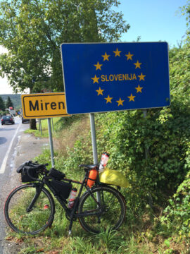
After riding through many villages and finding nothing open except for coffee bars, I sat down on a park bench and ate everything that I could find in my bags. I wasn’t enjoying riding in the Italian plains, and was happy to look at the map and see that the Slovenian border was not far away, with some good hills and valleys to tackle.
Almost immediately after I crossed the border to Slovenia, I found what I’d been looking for throughout Italy all morning – a petrol station that sold food and drinks. I bought a big bottle of Coke, a big bag of chips, an ice cream, and some chocolate bars and sat down outside and ate most of it straight away.
Most people doing this route chose the shortest route to Croatia, sticking close to the Adriatic, and so passing through the big city of Trieste. That didn’t appeal to me, so I’d chosen a route up a valley in Slovenia and into the hills. I was slowly getting some energy back and enjoying the scenery. At the top of the hills, I stopped to eat everything else substantial that I’d managed to find at the petrol station.
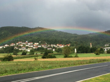
By the afternoon, the rain was seriously threatening again, and I was racing some storm clouds down what would have been a very pleasant valley. When the clouds appeared to be about to catch me, I stopped at a petrol station on the outskirts of a medium-sized town. My timing was perfect, because it rained harder than I’d seen the whole trip for almost an hour. I got on the bike as soon as it let up a bit and there was a beautiful rainbow as the sun returned, which heralded the end of the persistent rain that we had had throughout the first week of the race.
Several emergency vehicles came past as I went through town, and on the other side, I found out why – there had been a head-on collision on the road that I was taking to Croatia. The traffic was all backed up, and it didn’t look like it would be moving any time soon, and my GPS didn’t show any alternate roads for some distance. I went to the front of the queue and decided to try and pass the crash scene by carrying the bike over the grass bank on the opposite side to where the accident had occurred. Luckily, the police weren’t bothered by me doing this, so I then had an empty road to ride on until the border.
Having crossed the border, I again opted for a very minor road that would keep me away from the coast and the city of Rijeka. This turned out to be more great riding on rolling backroads, and I was going hard to make up for the time lost to the rain storm, car crash, and border crossing.
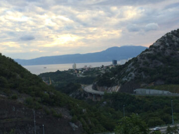
I finally saw the Adriatic sea as I passed high above Rijeka. The views were fantastic, which is not something that I’d expected from choosing this route, but was a big added bonus. The valleys, ridges, cliff roads, and bays were really impressive to see in the evening light.
I wouldn’t get to the coast for another 20km, and as I was trying to push hard along the valley to get there before dark, I spotted another Transcontinental Race rider up ahead. When I reached him, I found out that he had a similar plan, but we got distracted by talking and took a wrong turn, not realizing for 500 metres, but we took advantage of the great photo opportunity that we’d happened upon, then turned back to take the correct road. Luckily, this was the biggest navigational error that I made in the whole 3,600 kms. There were many people in the race who made many larger routing errors than this.
The rider was John Bakewell, who I’d actually met when doing the final few kms into the control point in Paris five days earlier. He decided to join me in my plan to find a hotel in Crikvenica, the town on the coast, and after a brief unsuccessful circuit of town, we asked at a tourist info office who directed us up the hill to a large hotel.
This was the end of the first week of the race and marked a major milestone for me – going from the countries, roads, and cultures that I was familiar with in western Europe to the unknown nations of southeastern Europe. One of my main tasks that evening was therefore to get out the maps and profile charts, see what lay ahead of me, see how much distance remained, and to make a rough plan for the coming week. I had done about 1700 km by then, but still had 1900 km to go. A couple of things had made the first week a bit slower: only being able to do 100 km on the first day before waiting for the ferry, plus crossing six Alpine passes in the previous two days. I should therefore have time to squeeze a couple hundred extra kms into the second week than I did in the first. I set my plan to average 275 km per day to reach Istanbul on the 14th day, which is what I had set as my rough goal from the start.
John was happy to look over the maps with me because he was looking for an easier route than he had originally planned, and liked my intention of heading south from the third control point in Montenegro to pass through Albania and Greece on the way to Turkey, instead of his plan that involved a hillier route through Kosovo and Bulgaria.
My adventure in southeast Europe was about to begin, and at that time I had no idea how incredible some parts would be and what problems I would face in other parts, visiting certain places that I would never want to visit again.
This page is in the My Bikepacking Race Reports section. The next page in this section is: